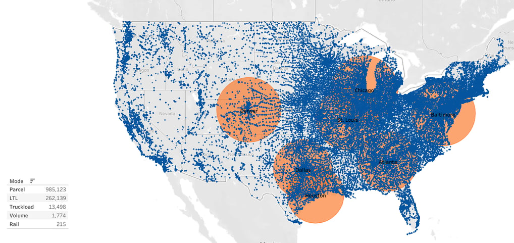
Warehouse Mapping


Project Details
Summary
For the Warehouse Mapping project, I developed a comprehensive map using Tableau that visualizes the locations of each warehouse, along with a 250-mile radius surrounding each facility. All shipments were plotted on the map, with the added functionality to filter by shipment mode and/or customer. This interactive map provided stakeholders with a clear visualization of warehouse distribution and shipment activity. It enabled easy identification of areas where additional facilities were needed, facilitating strategic decision-making regarding expansion and optimization of warehouse networks. Moreover, stakeholders could identify existing customers with high shipment volumes near company facilities, allowing for targeted outreach to encourage them to utilize company warehouses instead of third-party options. This proactive approach resulted in a significant increase in revenue, as more customers opted to leverage company facilities for their shipping needs.
